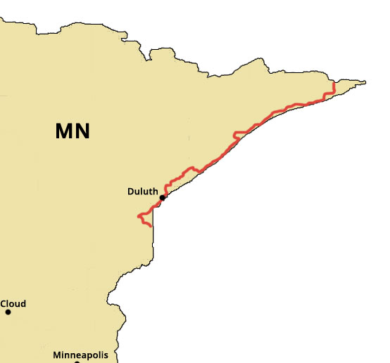
The Superior Hiking Trail is nestled along the ridges above Lake Superior in Minnesota. The trail runs 310 miles from the US-Canada border all way down through Jay Cooke State Park to the Minnesota/Wisconsin border. The official northern terminus of the SHT is at 270 Degree Overlook, just south of the Canadian border. While the southern most point of the trail meets the Wisconsin border and is considered the offical end of the SHT, thruhikers are given credit for hiking to the northern city limits of Duluth (Martin Road Trailhead), a total of 255 miles from the northern terminus. Thruhikers that plan to backpack south of Duluth should research camping and lodging options as there is only one public campground between Duluth and Jay Cooke State Park. North of Duluth, the SHT has over 90 designated campsites stretched out over the trail. Hikers can expect many views from the trail of Lake Superior, the Sawtooth Mountains, lakes, rivers, and several waterfalls.