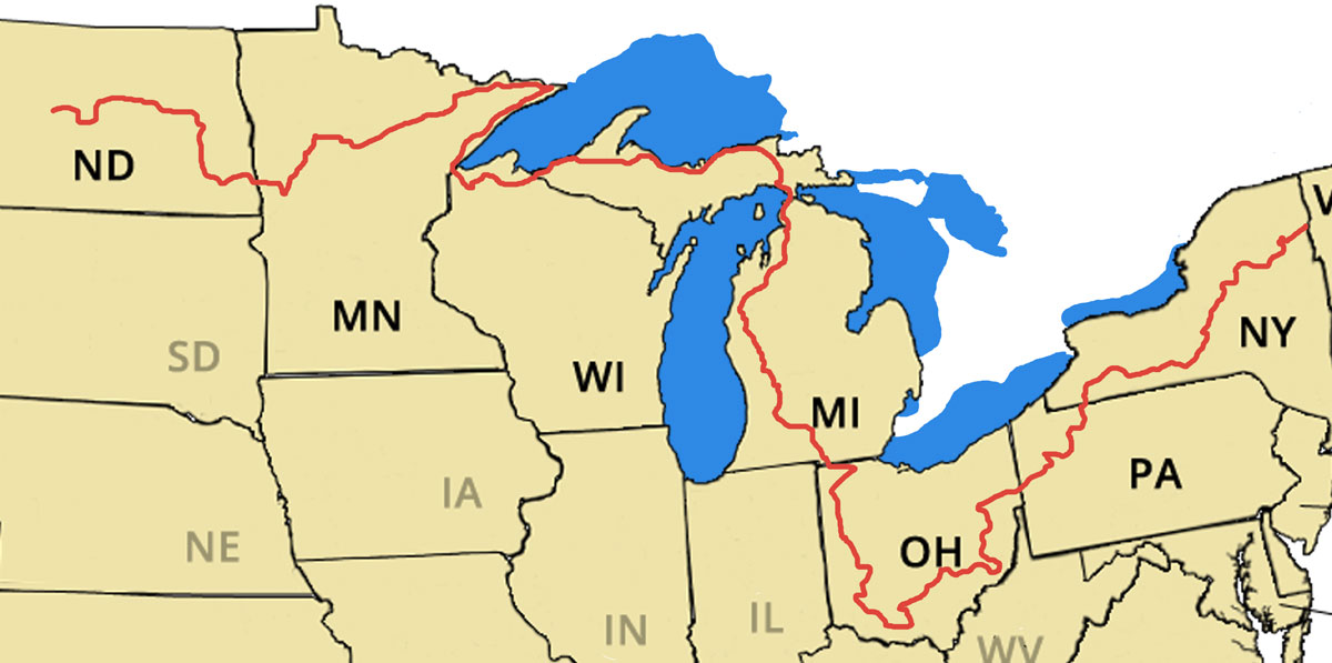
The North Country Trail (NCT) travels over 4600 miles from Crown Point, in eastern New York to Sakakawea State Park in central North Dakota, crossing a total of seven states. The trail begins in the Adirondacks of New York traveling southwest along the Finger Lakes region, then passes through northwestern part of Pennsylvania. Once the trail reaches Ohio is traverses the southern part of the state and turns north from Cincinnati and up into Michigan on the western side of the Lower Peninsula. The trail crosses the Straits of Mackinac and takes a northern route the length of the Upper Peninsula. From there the trail follows the southern shore of Lake Superior passing through Wisconsin, into Minnesota, and then north along the western shore. The trail turns west before reaching the US and Canadian border and heads into North Dakota. The NCT coincides with three other long trails through its route, the Finger Lakes Trail, the Buckeye Trail, and the Superior Hiking Trail. The NCT is the longest National Scenic Trail and is administered by the National Park Service.